This walk is circuitous, starting and ending at Grove Road (Map link) on the edge of Tithe Farm recreation ground. (Note: click or tap to enlarge any image).
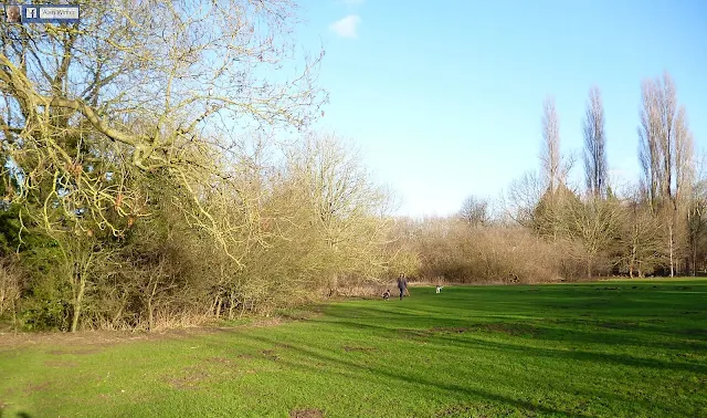
Above: If entering the walk from Tithe Farm recreation ground you have to weave yourself through or over the railings, otherwise there is a pedestrian entrance at the end of Grove Road. Marked as Bridleway 22 on the definitive map
Above: This is the first sight to greet you as you set off.
Take a good look at the view, because all of these foreground fields won't be there much longer. Over the next 18 years, these fields are destined to be built over as the site of "HRN1" Houghton Regis North, delivering in outline up to 5,150 new homes, some new shops and new schools. The road in the distance is the new A5 dual carriageway, completed in the spring of 2017, connecting the A5 at Thorn to a new M1 motorway junction, Junction 11a, at Chalton. The developers of the HRN1 site made a £45 million contribution to the construction of this road.
Above: View towards the northwest from the point on the map above, that I've marked as "Burnt out car". I swung the camera around to look southeasterly to take a picture of the burnt out car, below.
Above: Grove Road is on the horizon.
Above: This is the view just north from 'burnt out car' point, looking northeast. This was January, so expect the fields to be wet. In fact, if you haven't got a good pair of walking boots, forget it.
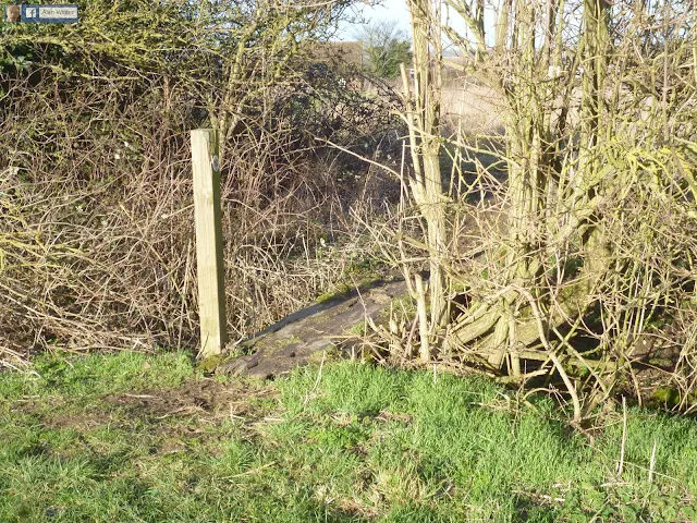
Head down towards the first bridge over the A5. A path - The Chiltern Way (BW60) - heads through trees to the east. This is at the point marked 'Stream on path' on the map above.
Water is gathering from the edge of the A5, and taking itself off towards the Ouzel Brook. This needs to be on a Highways England snagging list for corrective action. A pipe is required to take the water under the footpath.
The bridleway meanders along. The trees offer shade on a hot day.
Easy to step over, but I guess some people will find this tree down annoying. I tried moving it from the path but it was too heavy. One for the Central Beds Countryside team, perhaps, or maybe someone else who is willing to take a saw down there and sort it out.
Above: This is at the point I've marked 'sandbanks' . Not really sure what the line of sandbanks coming towards the camera position is supposed to be doing. If it's meant to be guiding water under the bridge lower right, it isn't working entirely, although water is flowing under the bridge.
Above: This is the end of the woodland walk. Is it an attempt to stop cars/bikes going through the footpath? Don't know. The large upended concrete pipe sections are filled with water. Next, it's a short walk on a bit further to the pedestrian bridge.
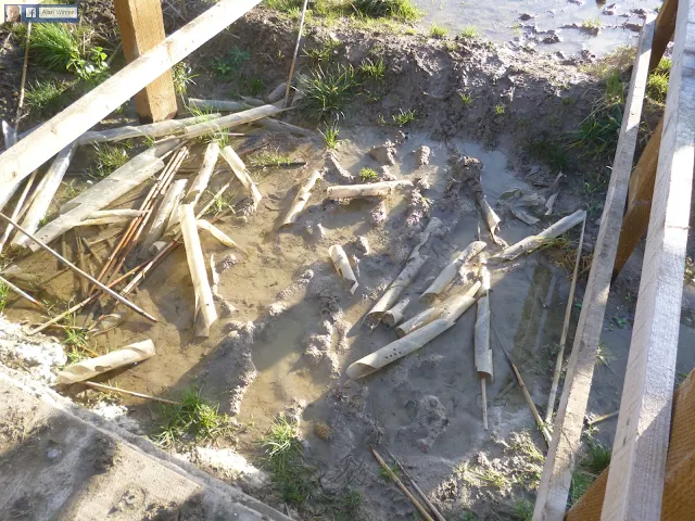
Below: Now, this doesn't look too clever. Apart from the fact that my boots got totally clogged up with mud just getting to the start of the small bridge, there is a wide muddy wet gap to get over. Since the take-off point was clogging up my boots so much and therefore ruling out a running jump, I settled for standing on, and shuffling my way along, the lower struts of the fence. (FP61)
Above: Is this discarded workmen's waste? They're garden canes, and they're meant to be stakes to support saplings growing on the slope leading up to the pedestrian bridge. All the same, one of these proves to be a handy tool to get the mud off the soles of my boots. (FP61)
Highways England, here's another snag for you. Sort out the canes and the saplings that are supposed to be staked and growing.
Once over the footbridge, and through a new gate, courtesy of the new A5, head north across the field to Chalton. At the top of the path go into the field at the rear of Chalton Heights. Below: The A5 is now behind you.
The Chiltern Way takes off again halfway down Chalton Heights, and, below, cuts past this old thatch cottage, now boarded up. The land is all fenced off either side of the Chiltern Way, marked 'Private Land' http://www.rowanhomes.co.uk (FP5)
The Chiltern Way passes through this playground at Chalton. (FP5)
... and then pops out onto the main road, the B579, opposite The Star, offering a lunchtime and evening menu. Booking on weekends and Friday or Thursday evenings recommended, and look out for opportunities to save through Tesco Clubcard vouchers. I've had many an enjoyable meal there.
At The Star, you need to head for the rear left-hand side of the car park. That's where The Chiltern Way continues. Here we head towards the M1 motorway and after that a footbridge over the Bedford - London railway line. (FP20)
 |
The footpath is blocked at this point, requiring a slight detour. Tree down across FP20 and a diversion is available on FP21.
Lane to the railway line. (FP14)
Below: after the railway bridge, there's a ploughed field to cross on what is earmarked for the Sundon freight exchange in the 2018 Local Plan. (CBC Maplink - FP1). My original route was to take me on FP1 across to Sundon chalk pits, on more land that is scheduled for the Rail Freight Interchange (see map below).
However, as the field was ploughed, and I'd had enough of boots being clogged up. Instead, I headed off up the concrete lane running north parallel to the railway.
In the Local Plan chapter 7, land either side of this lane will be swallowed up for a Rail Freight Interchange. Public Consultation on the plan is open until February 22nd 2018.
I always find them, don't I? Another couple of burnt out cars that have made their way down the lane from Sundon, and been trashed set fire to and left close to the track to rot away.
After a short while, I headed back west towards the railway line, going over a second railway footbridge.
There are other routes to take from FP2 back on the west side of the M1, which head more directly towards the Fancott Arms, but quite honestly, I couldn't tell just by looking at the terrain where those other paths were. Perhaps next time I'll have a compass and map with me and rely less on intuition.
As remarked upon, I headed from FP2 to FP47 ...
FP47 (CBC Maplink) heads across fields, passing close by Toddington Service Station.
Above: I particularly like this view on FP47 which has Toddington on the distant summit. And the view below a little further on. The words mud, and clog come again to mind.
FP47 leads into FP45 by the side of Cowbridge Farm, which takes you onto the road between M1 J12 and the Chalton - Toddington road. From there walk along kerbside to Fancott Arms.
As mentioned, there are other paths from the M1 FP2 to Fancott Arms. My walk ended at the Fancott Arms car park, as it was starting to rain and I was obligingly given a lift.
Had the weather stayed good, the walk can continue from Fancott on the roadside towards Chalton, until FP16 branches off to the right. That path and the Theedway (BOAT43)- a wide green route going west - will take you past Grove Farm, down to the A5, where you cross at the footbridge and then continue on BW22 where you walked earlier, to Grove Road. (Map Link)


