1 hr 10 mins. 5.45km walk. TL 01330 24509.
A great new temporary walking/running/mountain bike riding circular route has been created around the HRN2 development zone at Thorn. This new diversionary route has been created to make up for the loss of several paths while works are done over the next several months.
Several paths in the HRN2 development zone were stopped up as from 1st October 2018.
Public Notice Bidwell. According to the notice, ‘this temporary closure is required to safely carry out construction work. The closure is expected to take place from 01 October 2018 for a period of six months to 01 April 2019’.
Having now walked around the alternative perimeter route, I can say that the vast majority of the way should appeal to walkers, mountain bikers and runners, although in one or two spots you might find your boots clagging up with mud if it's wet.
Starting from the Red Lion car park on Bedford Road, proceed north to where the concrete path leads to Blue Waters Woodland. Follow the concrete path to the wood.
 |
| Path A-X is the Chiltern Way |
From the noticeboard at Blue Waters Woodland, you have a choice to go up the path, south, and then west along the edge of the chalk pit (X-P-Q-Y on map above), or else go west along the northern edge of Blue Waters Woodland (X -Y).
 |
| The view north from point X, Blue Waters Woodland edge north, towards Thorn Road. The once cultivated field has soon gone native. |
 |
| The view north-west from point X, Blue Waters Woodland edge. |
 |
| The path X-Y on the northern edge of Blue Waters Woodland |
 |
| View from edge of Woodland, south towards the Chalk Pit edge, mid-way between X and Y |
 |
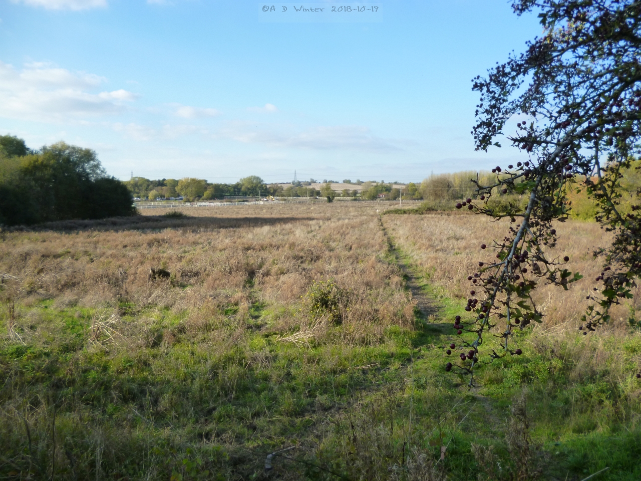
| View north towards Thorn Road from the path midway between X-Y. At this point, it is planned that a road will come through here. There's not a lot to see at the moment, just earth-moving vehicles, but a thousand new homes, parks, a school, a local shopping centre, and playing fields will be coming here. |
 |
| The lower path out of Blue Waters Woodland edge on path X-Y. The HRN2 design will make this up to a better grade than mud. |
 |
| Nearing point Y, the view east, back towards the edge of Blue Waters Woodland |
 |
| at point Y |
If you took the Chalk Pit edge, (X-P-Q-Y) head down to the eastern edge of the Sewerage Works to point Y. If you took the other route, turn north along the edge of the sewerage works. The route here has been fenced off on both sides to provide a path corridor.
About point Z on the map above, a pond has formed, and gulls are taking advantage of it.
Follow the fenced and waymarked route north to the Thorn Road (Z-C-T). Head west to the pegasus crossing, then north over that crossing (T-S)
 |
| Path T-S. The temporary pathway from pegasus crossing heading north to the A5 dual carriageway |
This northerly route takes you over the A5 dual carriageway on a new bridge. At a corner of the field ahead, turn west until you reach a waymarked post pointing you south, towards the next pedestrian bridge.
 |
| On path S-R |
 |
| On path S-R |
 |
| Path S-R. The temporary Icknield Way runs parallel to the A5 dual carriageway, off to the right. |
Path R-H-V. Once over the second A5 bridge, it might seem a bit perplexing where to go next, but confidently head down these steps south.
Path R-H-V.. Sharp left at the bottom along the fence line pictured on the right above, towards a waymarker. The waymarker then sends you south, down FP13 until you get to Thorn Road.
 |
| There is a line across the centre heading south to Thorn Road. |
 |
| Looking back to the A5 dual carriageway from Thorn Road, near its junction with Bedford Road. |
Once at Thorn Road you need your wits about you as for now you have to go 2 tenths of a mile up Bedford Road, while there's no footpath and it's the national speed limit. And it doesn't help that cars can be turning from Bedford Road into Thorn Road rather quickly. All this should improve in time; a roundabout is due to be built in 2019.
The grass verges will have to do. Across the road from the footpath, on Bedford Road, the Ouzel Brook, known to many locals as The Washbrook in this area, flows under a bridge.
From here on you're on route V-W main road to take you back to the Red Lion car park.
 |
| ‘Washbrook’ off to the west of Bedford Rd near the junction with Thorn Road. |
 |
| ‘Washbrook’ off to the east of Bedford Rd near the junction with Thorn Road (complete with a stray rugby ball from Dunstablians RUFC nearby) |
 |
| Bedford Road - National speed limit, no footpaths, the grass verge will have to do. |
Once the 40mph limit is reached, a public footpath is available. The Red Lion is up the road, on the right.
 |
| Cottages, Bedford Road. |
 |
| Bedford Road |
 |
| Red Lion ahead. |
Footnote: Sad to report that a fallen tree on the concrete path, a vandalised noticeboard at Blue Waters woodland, two vandalised Public Notices on waymarkers were all reported to the appropriate people at CBC after my walk.😒